Hiking Paths on the Gaisberg
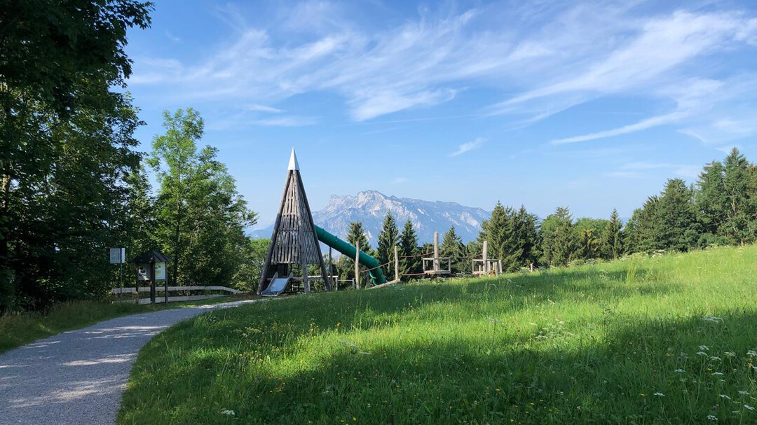
La montagne des Salzbourgeois (1.287 m) est un paradis de randonnée pour toute la famille. De nombreux sentiers offrent les meilleures vues sur Salzbourg et les montagnes environnantes. En particulier, le populaire circuit Zistel et le sentier de randonnée circulaire du Gaisberg conviennent parfaitement pour une excursion dans la nature.
Les sentiers de randonnée sur le Gaisberg durent entre 15 minutes et trois heures et sont bien balisés. L'accès aux sentiers circulaires se fait avec le bus n° 151 depuis le centre-ville, les sentiers commencent aux arrêts de bus des transports publics (généralement ligne 6 et 7). Tous les bus sont inclus dans la Salzburg Card.
Vous trouverez toutes les descriptions des itinéraires en détail sur le plan Gaisberg.
- Itinéraire 13a – Sentier circulaire Gaisberg - facile - 1-1½ h - env. 5,9 km - Point de départ : Zistelalm, ligne 151
- Itinéraire 13b – Tour Zistel - facile - 30 min - env. 2,6 km - Point de départ : Zistelalm, ligne 151 - adapté aux poussettes
- Itinéraire 13c – Sentier circulaire du sommet du Gaisberg - facile - 15 min - env. 1 km - Point de départ : Gaisbergspitze, ligne 151
- Itinéraire 12 – facile - 2¾ h - env. 6 km - Point de départ : Arrêt de bus Bildungscampus Gnigl, ligne 151 ou Obergnigl, lignes 2, 23
- Itinéraire 13 – moyen - 2½ h - env. 6 km - Point de départ : Arrêt de bus Ludwig-Schmederer-Platz, ligne 6
- Itinéraire 14 – Chemin AK - facile mais caillouteux - 2½ h - env. 8 km - Point de départ : Arrêt de bus Ludwig-Schmederer-Platz, ligne 6
- Itinéraire 15 – Chemin Dr. Herbert Walterskirchen - facile - 2¾ h - env. 11 km - Point de départ : Arrêt de bus Aigen S-Bahn, ligne 7
- Itinéraire 16 – facile - 3 h - env. 11 km - Point de départ : Arrêt de bus Josef-Kaut-Straße ou Valkenauerstraße, ligne 7
- Itinéraire 17 – moyen - long, depuis Zistelalm partiellement raide et glissant - 3 h - env. 11 km - Point de départ : Arrêt de bus Josef-Kaut-Straße (17a) ou Valkenauerstraße (17), ligne 7
- Romantikhotel Die Gersberg Alm
- Hôtel Restaurant Zistelalm
- Kasnocknwirt (anciennement Gasthof Mitteregg)
- Kohlmayr's Gaisbergspitz
- Rauchenbühelhütte
- Goasn-Alm


